Helping You Grow Wealth Through Real Estate
Helping You Grow Wealth Through Real Estate
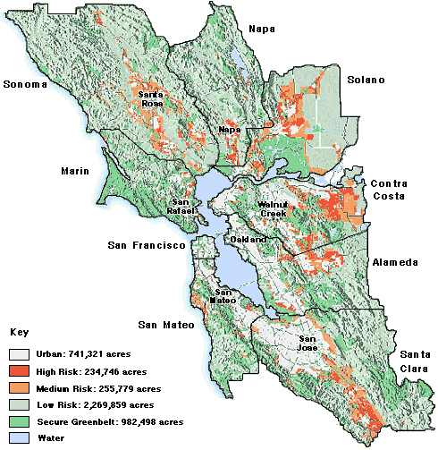
This map shows greenbelt areas considered "at risk" by The Greenbelt Alliance, a Bay Area land conservation organization which has used GIS-mapping techniques to map the threats facing the remaining acres of open space in the Bay Area. Click any area for local specifics.
Despite recent smart growth progress, nearly 500,000 Greenbelt acres could be paved by sprawl in the next 30 years, according to the Greenbelt Alliance’s report. Subdivisions, freeways, shopping malls, and large lot rural ranchettes all threaten our Greenbelt of open space, farmlands, watersheds, hillsides and recreational areas. More info: The Greenbelt Alliance home page
Direct: (408) 723-5200,